Hudson Valley Flood Risk

Hudson River flooding at Esopus Meadows Preserve in the Town of Esopus on December 23, 2022.
Background
The Hudson Valley in eastern New York includes the Hudson River estuary and its surrounding lands and waters. The Hudson River is a tidal estuary, affected by ocean tides, extending 153 miles from the Atlantic Ocean at New York Harbor north to the Federal Dam in Troy, New York.
The Hudson Valley has abundant water and a wide variety of landscapes, such as hills, forests, mountains, and wetlands. More than 200 smaller rivers and streams flow into the Hudson River. The region includes a wide range of land uses, including densely developed villages and cities, farms, and economic corridors. Communities across the watershed are increasingly vulnerable to flooding due to a changing climate, land use decisions, and development patterns within this unique geography.
Flood Hazards
Flooding puts lives, infrastructure, and property at risk. New York's climate is changing faster than national and global averages (see More Information, below). Hudson Valley communities are vulnerable to a range of flood hazards.
The entire watershed is at risk from more frequent and intense heavy downpours that contribute to more frequent fluvial (river) and pluvial (runoff) flooding.
On July 9, 2023, an unnamed storm dropped 8 inches of rain over the course of an afternoon in the community of Highland Falls, causing flash flooding that resulted in washed out roads, over a dozen rescues of stranded residents by emergency responders, one death (Gomez, 2023; Wilson, 2023).
In 2014, a brief extreme rainstorm caused severe pluvial flooding in the City of Albany.
Historically, tropical cyclones and nor’easters bring heavy precipitation and high winds that cause power outages and other cascading impacts that affect the local economy and disrupt access to food, schools, childcare, and other vital services.
In 2011, Hurricane Irene and Tropical Storm Lee passed over the region within a week of each other, producing extremely heavy rainfall that caused record flooding over wide areas. The storms caused an estimated $1.5 billion in damages that washed away roads, bridges, caused damage to homes and eroded stream banks (NWS Albany & NWS Boston, 2021).
In 2021, Hurricane Ida again devastated the lower Hudson region with flash flooding.
Coastal flooding – caused by storm surge or extreme high tides – is also increasing in communities along the tidal Hudson River estuary and tidal tributaries. This is due to the increases in storms that bring storm surge and the acceleration of sea level rise.
In 2012, one year after Lee and Irene, Superstorm Sandy caused record storm surge and coastal flooding along the entire length of the tidal Hudson River. Marina buildings were damaged or destroyed, docks and moorings were torn from their pilings, and boats were pushed on land. Many waterfront neighborhoods and businesses have never recovered.
More recently, on December 23, 2022, storm surge from Winter Storm Elliot combined with heavy rains that flooded waterfronts along the tidal Hudson River. Similar winter storms impacted the Hudson River waterfront again on December 18, 2023, and January 9, 2024, resulting in numerous, disruptive road, railroad, and school closures.
Because many waterfront communities along the tidal Hudson River estuary are located at the lowest point of the watershed, they are especially vulnerable to flooding from different sources, directions, and magnitudes. These can occur at the same time and together make flood conditions worse (Elko, N; 2022), commonly referred to as compound flooding.
High tide flooding (aka nuisance flooding, sunny day flooding) occurs without a storm event, and is happening more frequently as the maximum high tide increases with sea level rise. This can cause public inconveniences such as road closures, overwhelmed storm drains, and compromised infrastructure.
The City of Kingston reported 20 high tide flood events in 2023 that resulted in road closures and impacted business along the waterfront. This number is projected to rise to 60-80 events annually by 2050 (NOAA Annual High Tide Outlook).
These weather and flooding risks, along with eroding shorelines, aging infrastructure, and continued building in flood-prone areas, will increase dangers to people’s lives, homes, important infrastructure, and the health of the natural environment throughout the watershed.
The Need for a Network
Although local governments bear the primary responsibility for improving flood resilience, many do not have enough staff, funding, or support to advance this critical work. Flood planning is often carried out over many years by a small number of dedicated volunteers or municipal staff, but these roles can frequently change, and capacity is limited. Smaller towns, especially those with fewer than 2,500 residents, often lack staff and consultants with technical expertise in planning, floodplain management, and engineering. Flood preparedness is one of many responsibilities of municipal governments.
To address these challenges, the Hudson Valley Flood Resilience Network formed, serving as a regional network of municipal governments. The Network works to build a strong, collaborative Hudson Valley with a high resilience to flooding and other related extreme weather events. The Network is unique in its focus by centering the unique needs and work of municipal governments within the Hudson Valley. More information about the Hudson Valley Flood Resilience.
For More Information on Flood Risks
For more information on flood risk and response in the Hudson Valley, visit New York Sea Grant’s Hudson Dynamic Shorelines StoryMap collection.
For regional projections of future flood risk, see the New York State Climate Impacts Assessment.
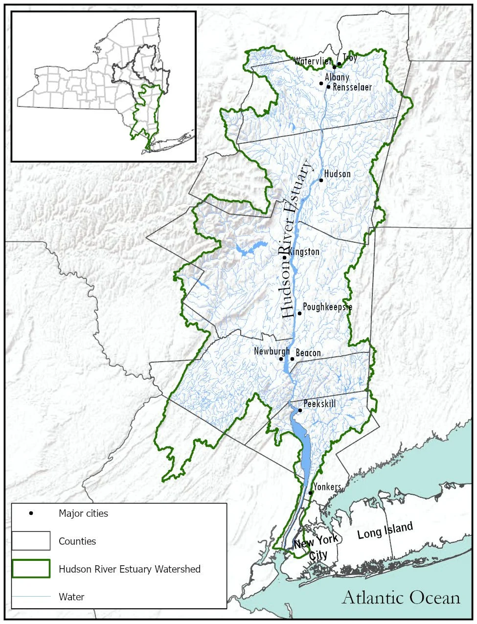
Map of the Hudson River estuary watershed and Hudson Valley region.
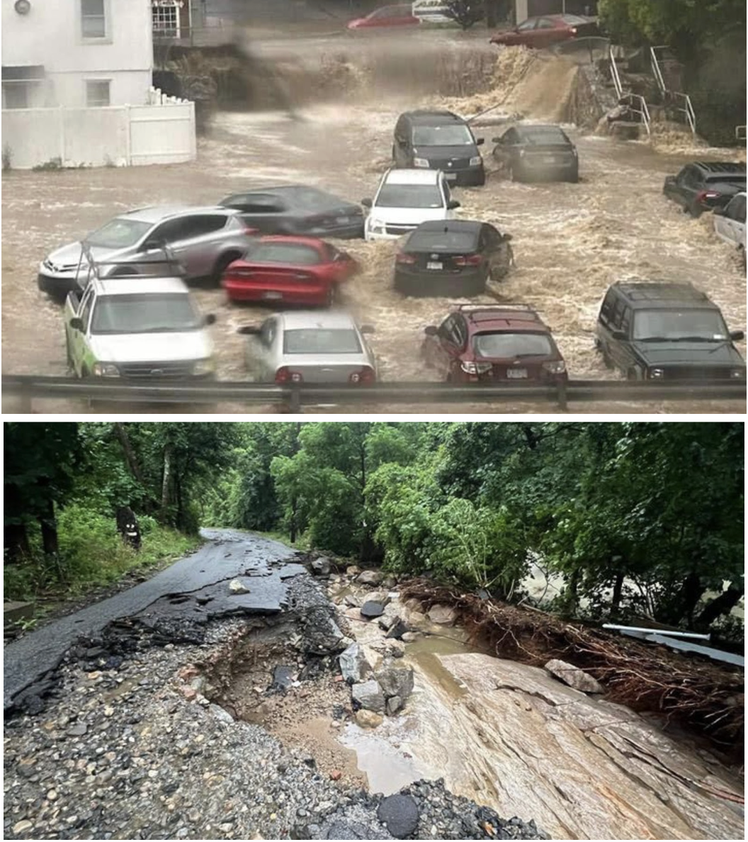
July 10, 2023 Top: Unnamed storm that caused historic flash flooding in Highland Falls. Bottom: Damage to roads in Orange County. Credit: (Gomez, 2023)
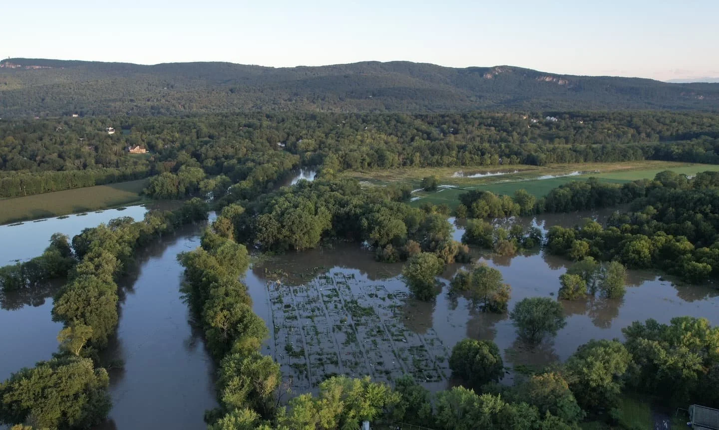
Wallkill River flooding in the Town of New Paltz following Hurricane Ida in 2021 (photo by Robert Fagan)
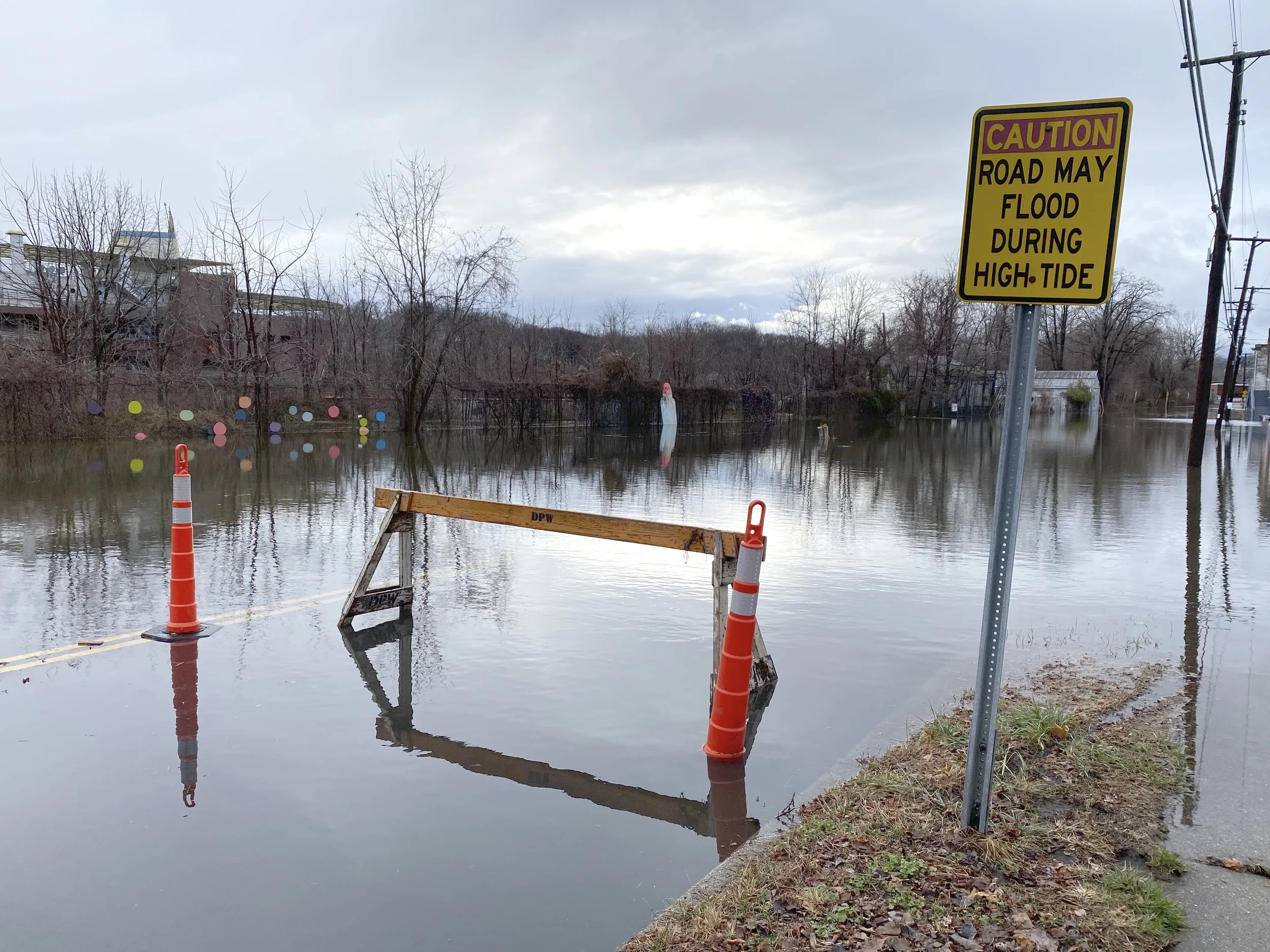
Storm surge flooding in the City of Kingston during Winter Storm Eliot, December 2022.
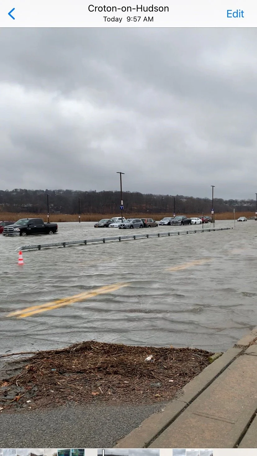
Storm surge flooding in Croton-on-Hudson during Winter Storm Eliot, December 2022. (Photo from MyCoast)
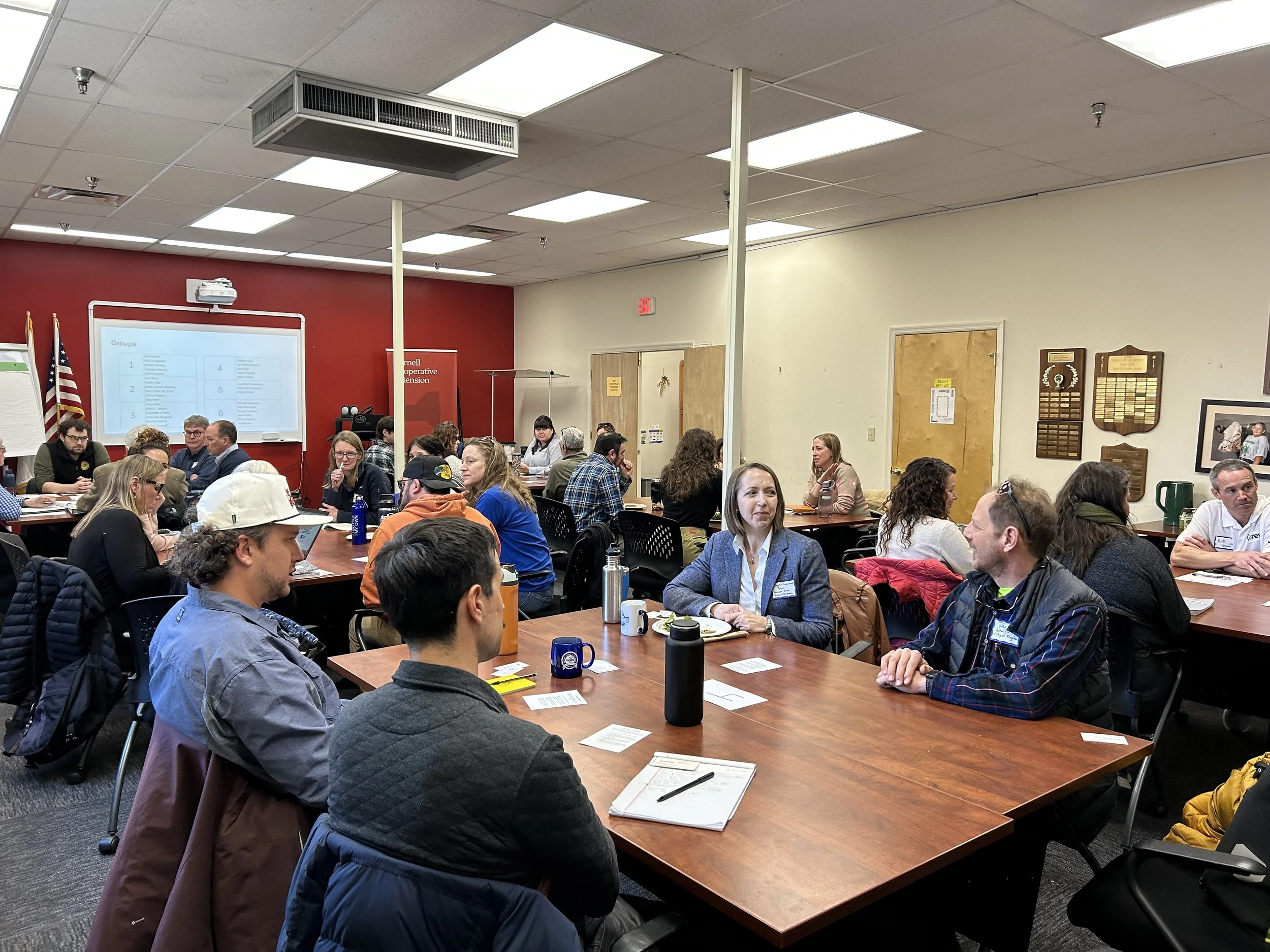
Hudson Valley Flood Resilience meeting and site visit in Kingston, NY, March 2025.
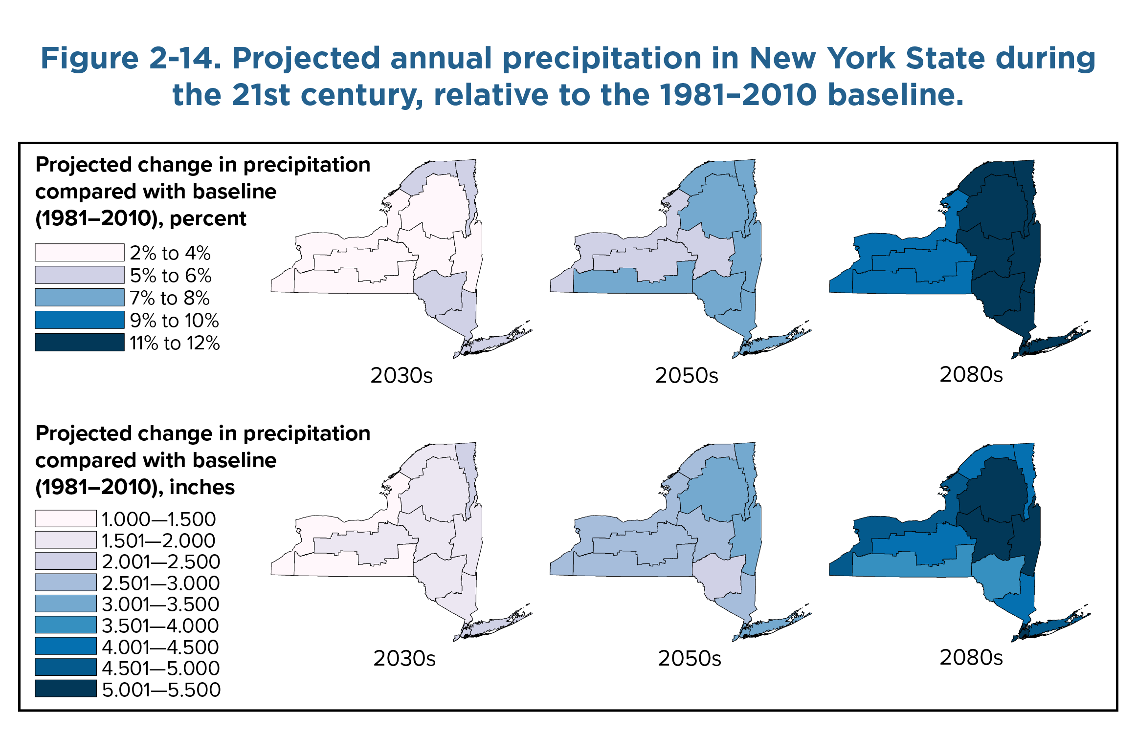
Projected annual precipitation in New York State from the New York Climate Impacts Assessment (2022).
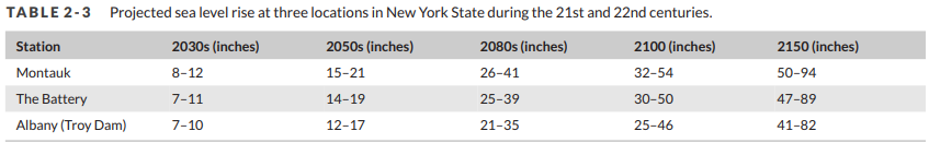
Projected sea level rise in New York State from the New York Climate Impacts Assessment (2022).